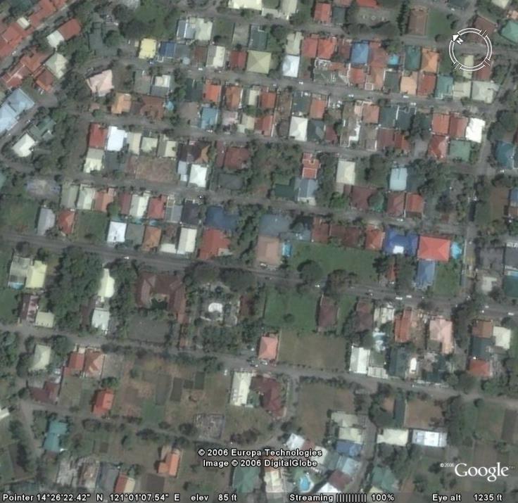
Google Earth Philippines
I'm sure alot of people know and use Google Earth. I'm not going to praise it, nor enumerate its features; many people have done that before me. Rather, I'm going to point out the fact that for a few weeks now, parts of the Philippines are now detailed. No longer do we have to put up with pixelated terrain for Metro Manila; you can now zoom in and see the street layouts (check out Fort Bonifacio!) and even roofs of houses!
Lately, I have been doing many trips down memory lane, and this updated Google Earth has made me look for some of the most significant places in my life. Here they are (in no particular order):
E De Leon
Villaba

Posadas

Can you find your own rooftop in Google Earth?
La Vita e Bella!
posted by Vince @ 3:12 PM
![]()
![]()

0 Comments:
Post a Comment
<< Home